We found on the internet a trail called Juansi Waterfall 絹絲瀑布 Trail and we wanted to check if the waterfall was impressive or not. Beforehand, we learnt that this trail is quite easy, almost only downhill. Compared to hiking to Mt Qixing, this should be a "walk in the park".
We took Bus No 260 north exit 2 of Taipei Main Station and reached to Yangmingshan terminal station. From there, there is a special queue for Bus 108, which is a small bus, that loops around Yangmingshan. Our target was Lengshuikeng 冷水坑 where we could to start hiking from there to Juansi Waterfall.
There were a lot of people around lunch time and suddenly they used a bigger bus (still Bus No 108) with end station Xiaoyoukeng 小油坑. We didn't know if Lengshuikeng was included in this bus line, so we jumped on the bus together with almost all the other people. It turned out that we were on the wrong bus. The bus reached Xiaoyoukeng and turned back to terminal station. I asked the driver how we should go to Juansi Waterfall and he then stopped at Qixing bus stop so that we could catch the real 108 instead.
I read a forum that we should start from Lengshuikeng Visitor Center, but there was no such bus stop. We passed Lengshuikeng and arrived to Qingtiangang 擎天崗, which was the other end station, not far from Lengshuikeng. It turned out that Lengshuikeng stop was the one we were supposed to go to, not a stop called Lengshuikeng Visitor Center, because that doesn't exist. This was explained by a guy in the Qingtiangang Visitor Center who was kind enough to bring us to a trail so we could hike to Juansi Waterfall anyway. This was not what we planned, but anything goes if we only could reach our target.
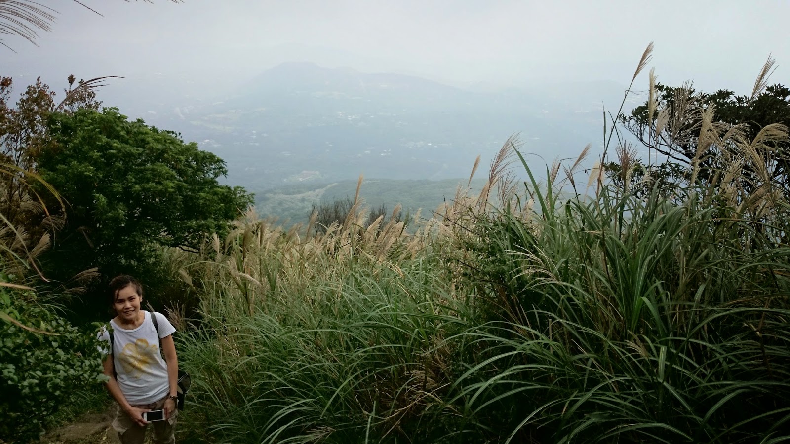
Qingtiangang is a nice and quite flat grassland with cows and people go there for picnicking or just to relax. Here used to be a lava terrace! Yes, we passed by a few cows and some cute calves and the visitor center guy told us they are Japanese cows and the farmers don't milk them.
We started hiking from here and arrived to the waterfall after just 1.7km. It took around 1h. The waterfall itself was not very impressive. It was quite small actually. However, a waterfall is a waterfall and it always brings some "magic" to it. It began raining when we reached the waterfall. We stopped here for a small sandwich lunch before hiking 1km for 30min to the end of Juansi Waterfall trail. We arrived to a road with a bus stop for Bus No S15 to Shilin MRT. All the buses which passed by were too crowded. It was nearly 16:00 and we expected to catch a bus sooner or later. However, after 30min with buses that were crowded or didn't come regularly, we decided to take S15 on the other side instead, ie back to the end station on the mountain so that we could remain in the bus which will turn back and go to Shilin MRT. However, the driver told us that we needed to get off the bus at Qingtiangang and line up again. Most of us were pissed. I was already so frustrated about waiting too long for the bus back to the city. It was raining and I was freezing and I just wanted to go back to watch a football game.

Qingtiangang

Qingtiangang

Qingtiangang
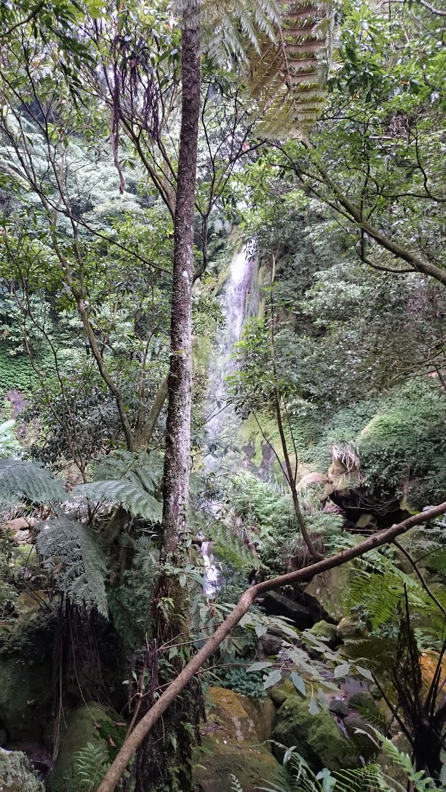
Juansi Waterfall.


We lined up for 1h in Qingtiangang in the rain and the fog before we could catch the bus back to the city. It was a nightmare and I can't believe that they didn't organize to have bigger buses when they knew that everyone wanted to go home in the rain.

Waiting for the bus back to Taipei.
However, all in all, the Juansi Waterfall Trail was quite nice and was not tough at all.